The site is located on land west of Moorsfield Avenue and provides a great opportunity to deliver a sustainable and attractive new neighbourhood in Audlem.
Location
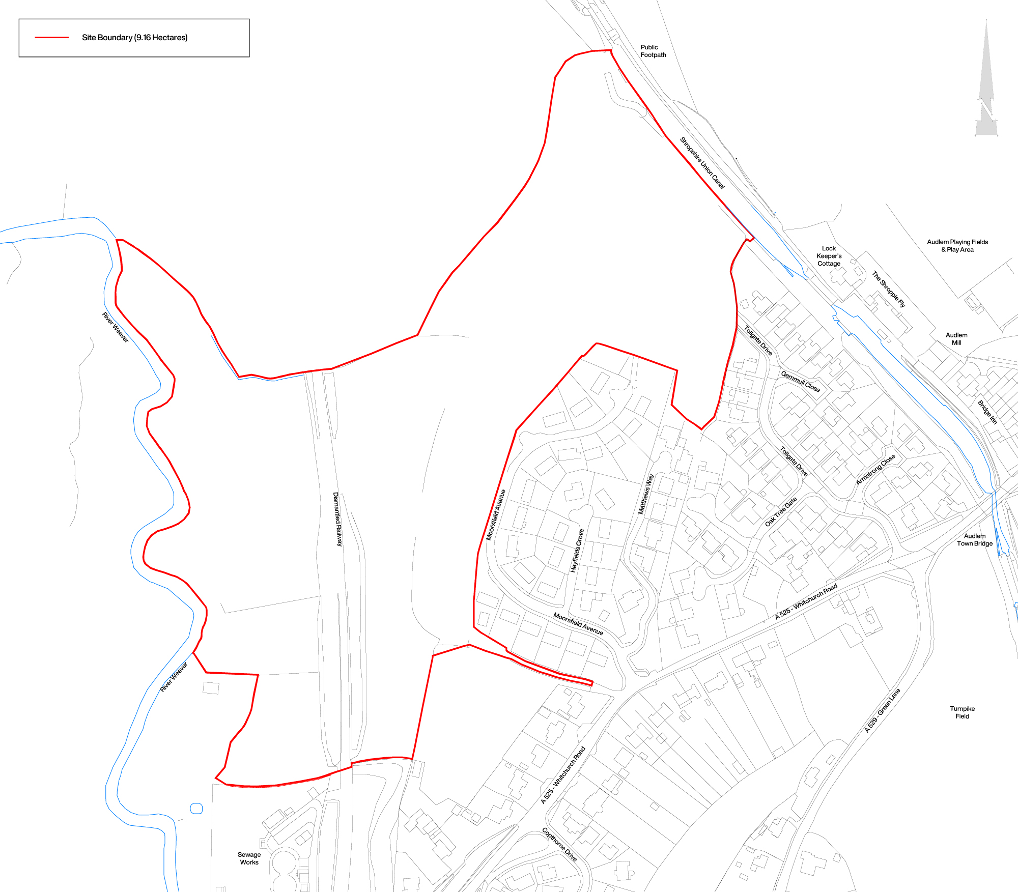
The proposed development site comprises circa 9.16 hectares of greenfield land located on the south-western edge of Audlem, adjacent to the existing built-up development.
The site boarders an existing housing development to the south-east, the A525 (Whitchurch Road) runs close to the site to the south-east and the Shropshire Union Canal forms the north-eastern boundary of the site. The western boundary is formed by the River Weaver and the village centre is located a 300-meter walk to the east of the site.
The site benefits from excellent connectivity to local amenities, including schools, shops, pubs, and a doctors surgery. The A529 provides a direct route into Nantwich and surrounding areas, while the site also has easy access to the M6, and the wider Strategic Road Network.
Moorsfield Avenue Site Location Plan – Click to Enlarge
Site Constraints & Opportunities
The site is not located within the green belt and has few technical constraints to sustainable development. While currently designated as Open Countryside under Policy PG6 of the adopted Local Plan, the site presents a viable opportunity for sustainable residential development in an edge of settlement location close to the village.
Detailed environmental and technical studies have provided a robust understanding of the site which has helped inform our emerging concept proposals through a thorough design and assessment process.
While the proposals will slightly extend Audlem’s boundary, they will not go beyond the River Weaver. The south-west portion will remain public open space, preserving its semi-rural character. With strong natural boundaries, limited public visibility, and enhanced landscaping, the development will integrate seamlessly into its surroundings as a sustainable extension of Audlem.
In Summary:
Landscape: Not within a National Park, Green Belt, National or Local Landscape designation.
Ecology: No statutory ecological designations on-site or nearby.
Flood Risk: The majority of the site is in Flood Zone 1 (lowest flood risk category) with a small part of the site to the west situated in Flood Zone 3 – this area has been identified for Public Open Space, Biodiversity Net Gain enhancements and will provide a niche habitat and wetland area.
Heritage: No heritage assets on-site, with only a small portion bordering the Audlem Conservation Area.